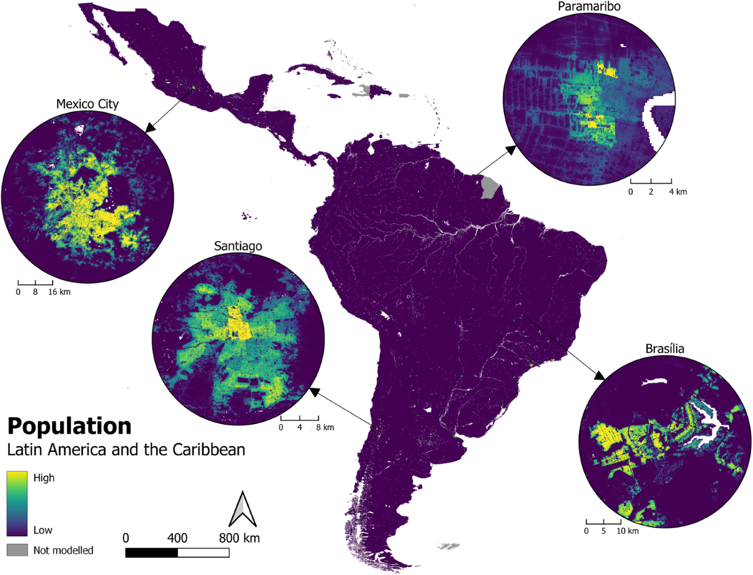
High-resolution gridded population datasets for Latin America and the Caribbean using official statistics
Abstract: “Leaving no one behind” is the fundamental objective of the 2030 Agenda for Sustainable Development. Latin America and the Caribbean is marked by social inequalities, whilst its total population is projected to increase to almost 760 million by 2050. In this context, contemporary and spatially detailed datasets that accurately capture the distribution of residential population are critical to appropriately inform and support environmental, health, and developmental applications at subnational levels. Existing datasets are under-utilised by governments due to the non-alignment with their own statistics. Therefore, official statistics at the finest level of administrative units available have been implemented to construct an open-access repository of high-resolution gridded population datasets for 40 countries in Latin American and the Caribbean. These datasets are detailed here, alongside the ‘top-down’ approach and methods to generate and validate them. Population distribution datasets for each country were created at a resolution of 3 arc-seconds (approximately 100 m at the equator), and are all available from the WorldPop Data Repository.


